Wildflowers in Paso Robles & the Superbloom Trip
Take the back roads and cruise your way to spring color. In Paso Robles, wildflower season spills across vineyard edges, climbs oak-covered hillsides, and threads through miles of trails brightened by multicolored blooms. Some years bring bigger wildflower displays than others, depending on winter rain and spring temperatures, but the reward is always in the journey. These are the local, easily accessible Paso Robles wildflower spots worth knowing, whether you're looking for a relaxed joyride where wine country meets cowboy country or a natural lead-in to a bucket-list day trip to the vibrant Carrizo Plain.
- When to See Wildflowers in Paso Robles
- Where to See Wildflowers in Paso Robles
- What Types of Wildflowers in Paso Robles
- Scenic Drives for Wildflowers (No Hiking Required)
- Wildflower Walks and Easy Hikes
- Local Stops to Pair With Wildflowers
- Carrizo Plain Superbloom From Paso Robles
- Leave No Trace in Wildflower Season
- Wildflower & Superbloom FAQ
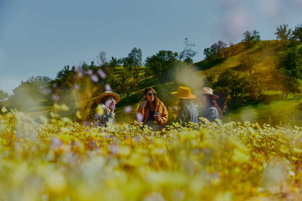
When to See Wildflowers in Paso Robles
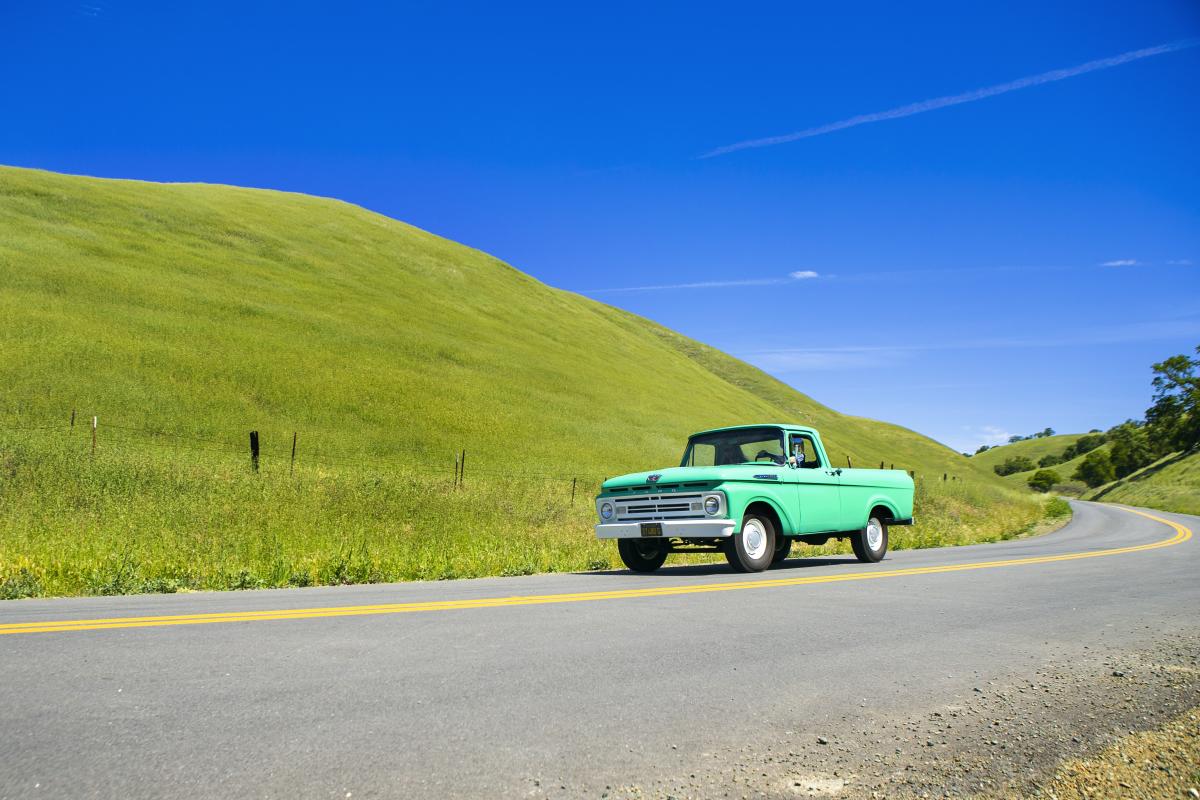
Timing is everything with Paso Robles wildflowers, and a quick check of local conditions before you leave can make all the difference. The good news: whatever the spring season brings, there's always a tasting room, vineyard view, or trail worth pulling over for along the way.
-
Late February – March: The first blush of color breaks along sunny, south-facing slopes and open roadsides. Early bloomers lead the way, with the palette deepening and spreading week by week.
-
March – April: Peak season in most years. Vineyard edges, grassland preserves, and hillside trails come alive with wave after wave of spring color.
-
April – early May: Later bloomers fill Paso's shaded canyons and higher elevations with a fresh flush of color. A great window if you missed the earlier peak.
-
Microclimates matter: Paso's cooler, wetter west side tends to bloom later and hold color longer. Open grasslands pop early; oak-shaded trails reward a visit well into spring.
-
Best time of day: Rise early and make the most of it. Morning light keeps flowers upright, golden hour makes colors glow, and you'll beat the midday wind that flattens delicate blooms by afternoon.
-
What you might find: Paso Robles and Carrizo Plain are known for putting on some of California's most colorful spring displays, with hillsides and valley floors washing through waves of orange, purple, yellow, and pink as the season unfolds. Exactly what's blooming depends on the year, the rainfall, and where you explore. Every season paints its own picture.
Where to See Wildflowers in Paso Robles
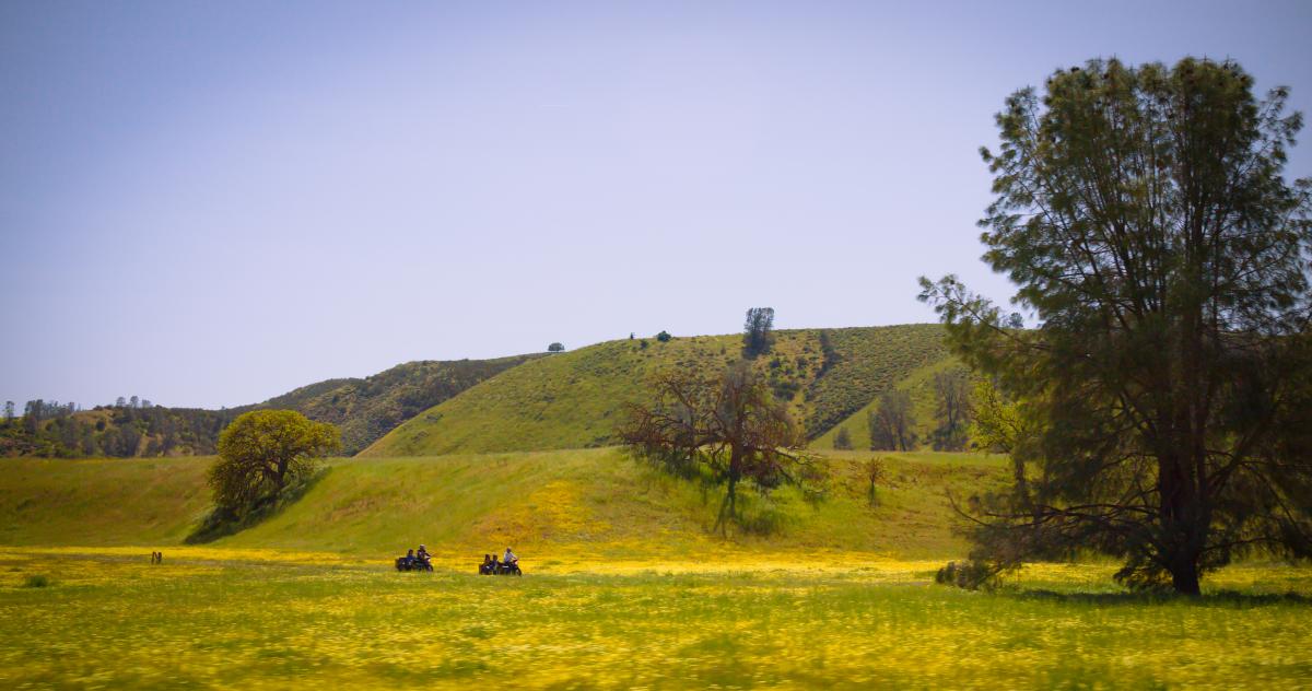
Get outside and see what's blooming. The best spring wildflower spots in Paso Robles are strung along the same back roads that wind past family wineries, horseback riding outfitters, and wide open ranch land that feels a world away from downtown. All it takes is a full tank and a willingness to pull over when spring blooms appear around the bend. Explore these locally-loved spots below and let the season surprise you.
Adelaida Road
Wind west out of Paso Robles on Adelaida Road and feel the landscape shift: quiet, green, and tranquil, with oak-studded hills and vineyard views speckled with cheerful spring flowers. Color threads through hillsides, roadside edges, and the spaces between vineyards, turning the drive into a slow-moving search for the next awe-inspiring pull-out. With tasting rooms tucked into the hills along the way, it's easy to pair a wildflower joyride with an afternoon exploring the Adelaida District, home to Adelaida Vineyards, Tablas Creek, and Halter Ranch.
- Best season window: March through April in most years, though a wet winter can extend color into early May
- Difficulty/accessibility: Easy. Best experienced as a scenic drive with winery stops; stroller-friendly at tasting rooms
- Parking/road conditions: Paved but narrow and winding in stretches. Use winery entrances and formal pull-offs rather than roadside shoulders
- Photo tips: Use the folds of the hills and oak-studded terrain for depth. Stay on road edges or winery grounds rather than stepping into sensitive areas
Vineyard Drive
Head northwest out of Paso Robles on Vineyard Drive via Highway 46 West or Nacimiento Lake Drive, where spring green extends into wide valleys and gently rolling hills dotted with blooms of all colors. Seasonal color shows up in broad sweeps along vineyard edges, fence lines, and open fields, making this one of the easiest places to enjoy the season without leaving the road. With classic Paso winery tasting rooms like Jada Vineyard and Winery, and Opolo Vineyards, along the way, it's easy to pull in, linger a while, and turn a wildflower drive into a full afternoon of Pasobilities.
- Best season window: March through April in most years, with color appearing earlier in open fields than along shaded edges
- Difficulty/accessibility: Easy. Best experienced as a scenic drive with winery stops; limited stroller accessibility beyond tasting room grounds
- Parking/road conditions: Paved. Formal pull-offs are limited, so only stop where you have ample safe space and clear visibility
- Photo tips: Frame blooms against rustic fencing, vineyard rows, or distant hills
Highway 46 West Corridor
Head west on Highway 46 and fold Paso Robles wildflower viewing into a coastal day as the route meets Highway 1 near Cambria and the glittering Pacific beyond. In spring, color appears in pockets between vineyard rows, across open ranchland, and along coastal hills that line the drive, rewarding those who take it slow. With well-known wine tasting stops like Castoro Cellars, Niner Wine Estates, and Sextant Wines along the corridor, it's easy to build in a tasting or two. Looking for a coastal spring drive from vineyard to sea? Wildflowers adorn seaside bluffs all along Highway 1 and the California coastline.
- Best season window: March through April. Open ranchland tends to pop earlier than shaded vineyard edges
- Difficulty/accessibility: Easy. Drive-first experience with winery stops; stroller-friendly at tasting rooms and designated pull-offs
- Parking/road conditions: Paved and straightforward. Park at wineries or designated pull-offs rather than the roadside shoulder
- Photo tips: Look for foreground color with vineyard rows and hills behind you as the landscape shifts closer to the coast
Santa Rita Road / Templeton Gap
Drop south and slightly west toward the Templeton Gap and let Santa Rita Road work its magic. Open hills, vineyard views, and a landscape shaped by cooling coastal air give this corridor a softer, greener feel in spring, with color unfolding across the whole drive. With tasting rooms like Lone Madrone Winery, Linne Colado, and Turley Wine Cellars nearby, pull in for a tasting or pause at a quiet roadside turnout before finishing with a meal in Templeton on the way back.
- Best season window: March through May; colors last slightly longer than most Paso spots thanks to cooler coastal influence
- Difficulty/accessibility: Easy. Mostly a scenic drive with winery stops; shoulder space is limited so winery entrances are the safest place to pull over
- Parking/road conditions: Paved. Limited shoulder space means winery stops are the most practical option for getting out
- Photo tips: Late afternoon light is especially flattering here. Work the open sky and hills into the frame from a safe winery turnout
Creston Road / Eastside Ranchland
Head east on Creston Road where warmer terrain unfolds into a patchwork of ranchland, vineyards, and farms. After particularly wet springs, color sweeps across hillsides and open fields in a flash, though it can disappear just as quickly. This corridor is also home to Paso's Backroads Wineries Trail, along with small-batch olive oil producers, mom-and-pop tasting rooms, and book-ahead Paso experiences like Central Coast Trailrides, where you can take in spring blooms via horseback. For a truly unique way to experience spring on the back roads, Third Wheel Sidecar Tours offers guided wildflower and wine-country rides through the region, including evening tours of Cass Winery vineyards in golden light. Let someone else take the wheel and enjoy the view (just remember to reserve your ride in advance).
- Best season window: March through April. Open ranchland picks up color early in wet years and holds it longer than more exposed hilltops
- Difficulty/accessibility: Easy. Best suited to a scenic drive with occasional stops
- Parking/road conditions: Paved. Formal stopping areas are limited, so plan ahead and never stop on blind curves or narrow shoulders
- Photo tips: Wide shots work best here. Find a safe public vantage point and let the sweep of the hills do the work
Santa Margarita Lake Regional Park
Venture south to Santa Margarita Lake and discover one of the most versatile wildflower outings near Paso Robles. Oak woodland, open grassland, and wildflower-dotted lakeside trails come together in a setting where you can explore multiple landscapes in a single visit. With well-marked paths, shaded stretches, and easy access to the water, it's a natural pick for a family day of wildflower chasing. Pair this stop with lunch, wine tasting, or even a zip-line tour in Santa Margarita, or continue on toward Carrizo Plain for a more sprawling wildflower spectacle.
- Best season window: March through May, with oak-shaded trails holding color later into the season than open grassland areas
- Difficulty/accessibility: Easy to moderate depending on the trail. Flatter options available closer to the lake; some sections more stroller-friendly than others
- Parking/road conditions: Designated parking lots with day-use access make this one of the more straightforward spots to arrive at
- Photo tips: Use the lake, trail edges, and oak canopy to add depth and dimension. Stay on established paths rather than cutting across natural areas and wildlife habitats
Avenales Ranch
Head out along Shell Creek Road toward Shandon, about 30 minutes from downtown Paso Robles, to see why Avenales Ranch earns its reputation every spring. A working family ranch since the 1870s, the property has been sustainably managed across generations, and the land rewards that care with breathtaking color when the rains cooperate. Walk the property, take in the sweeping ranch scenery, and pick up a bottle of estate wine on the way out, with labels inspired by the very blooms you’re marveling at. It also makes a logical stop on the drive southeast toward Carrizo Plain, with the scenery only getting more impressive from here. Visits are typically by appointment, event, or during specific open days. Always call ahead to confirm visiting hours, tasting availability, and any access requirements before making the trip.
- Best season window: March through April in strong rain years. Bloom intensity varies with winter rainfall
- Difficulty/accessibility: Easy. Walking along Shell Creek Road and ranch property where permitted
- Parking/road conditions: Shell Creek Road is narrow with limited pull-offs. Park only in designated safe areas and never on blind curves
- Photo tips: Wide open ranch land rewards broad landscape shots. Stay on the road or permitted areas and respect the working ranch property
What Types of Wildflowers in Paso Robles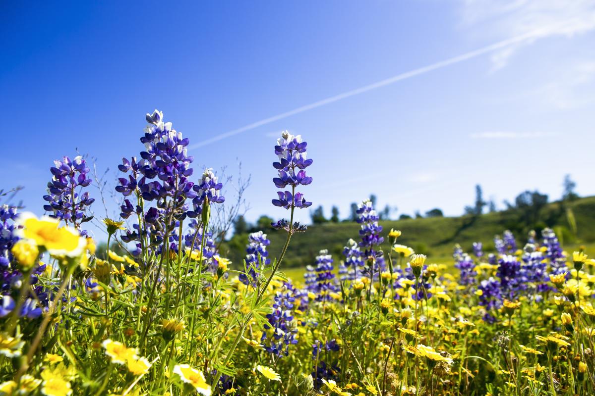
What types of wildflowers grow in Paso Robles: The Paso Robles region and nearby Carrizo Plain are known for putting on some of California's most colorful spring spectacles, with hillsides and valley floors washing through waves of orange, purple, yellow, and pink as the season unfolds. Exactly what's blooming depends on the year, the rainfall, and where you explore. Every season is unique. In strong bloom years across both regions, keep an eye out for:
-
California poppies: The iconic orange bloom that signals spring across Paso's hillsides, open roadsides, and scattered along vineyard edges
-
Lupine: Tall purple spires that appear in patches across grasslands and along Paso's back road corridors
-
Owl's clover: Deep pink and magenta clusters that mix beautifully with other blooms in open fields throughout the region
-
Goldfields: Low-growing yellow blooms that saturate open grasslands in Paso and spread in vast, unbroken sweeps across the Carrizo Plain valley floor in strong bloom years
-
Phacelia: Dense purple and blue clusters most dramatically on display at Carrizo Plain, where they can cover entire hillsides in waves of color
-
Tidy tips: Cheerful yellow and white daisy-like flowers common across open grassland areas in both Paso and Carrizo Plain
Scenic Drives for Wildflowers (No Hiking Required)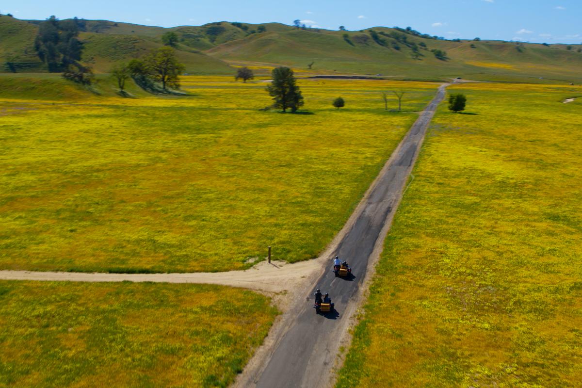
Spring in Paso Robles is made for scenic drives. Some of the best wildflower viewing happens right from the driver's seat, where color washes across hillsides, vineyard edges, and open fields as you go. Roll the windows down, pick a route, and let the beauty unfold. These are the kinds of drives built for slowing down and savoring each moment without a trail map, though a little local direction goes a long way.
-
Westside Wine Country Loop (30–60 minutes): Start in downtown Paso Robles and head west on Highway 46, then wind north onto Vineyard Drive before looping back into town, linking together two of Paso's most scenic spring corridors. Color shows up after spring rains, with tasting rooms and coastal Highway 1 within reach. Best in the late morning when westside hills are bright, and the light is still soft.
-
Templeton Gap Sunset Drive (30–45 minutes): Head south toward Templeton and cut west through the Gap, where rolling grassland and scattered oaks frame Paso's softer, lusher side. This is the drive to time for sunset, when the light tinges petals with gold. Follow it up with a stop in Tin City for a casual after-hours wind-down, whether that's a beer and live music at BarrelHouse Brewing or a fresh pasta dinner to close out the evening.
-
Eastside Run (45–60 minutes): Cruise east from Paso Robles on Creston Road for a quieter, more rugged wildflower experience. Vineyards and working farms stretch out beneath wide skies, with pops of color showing best in strong rain years. From here, it's easy to connect to Paso's Backroads Wineries or continue toward Highway 46 East, where the Sensorio immersive art exhibits invite wildflower chasers into an otherworldly and imaginative experience at the intersection of art, light, technology, and nature.
Roadside note of caution: Ready to cruise through Paso's best wildflower scenic drives? Remember, always pull over only where it's safe and legal, avoid blind curves, and use winery entrances or designated lots whenever possible.
Wildflower Walks and Easy Hikes
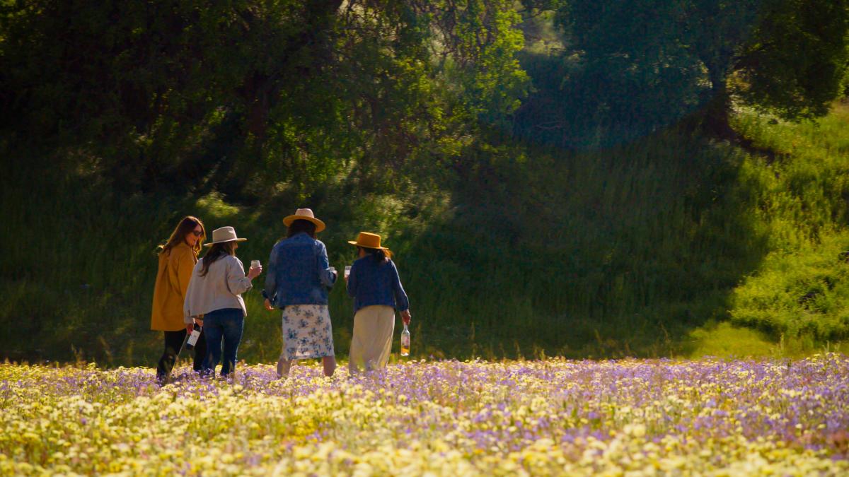
Get out of the car and into the bloom. The best wildflower trails in Paso Robles bring you outdoors in Paso, close enough to catch the buzz of pollinators working the buds. Most options here are accessible and family-friendly, with a handful of moderate routes for anyone who wants to claim a more rugged vantage point. Feeling the buzz of Paso in spring? Note that spring means mud in wet years. Check conditions before heading out, stick to established trails, and keep dogs leashed where permitted.
Barney Schwartz Park Trails
No need to stray far from downtown. At Barney Schwartz Park, wander through open hillside and around a lakeside setting that makes a spring wildflower walk effortless. A network of short loop paths circles the lake and nearby fields, offering relaxed bloom viewing with little to no elevation change. With wide paths, open space, and plenty of room to spread out, it's a natural fit for families, casual walkers, and anyone looking to pair a wildflower outing with a picnic.
- Trailhead/parking: Barney Schwartz Park, 2970 Union Rd, Paso Robles, CA
- Distance: 1–2 miles depending on loops
- Difficulty/surface: Easy. Flat, paved, and decomposed granite paths
- Shade vs sun: Mostly open with limited shade
- Dogs: Allowed on leash
- Facilities: Restrooms, picnic tables, playgrounds, sports fields
- Seasonal notes: Best in spring for surrounding hillside color. Dirt sections can be muddy after rain
Salinas River Walk
Trace the Salinas River through Paso Robles on a flat, accessible path that brings a touch of spring to a popular family outing. This is a quieter, everyday kind of walk where color shows up in pockets along the trail, mixed with fresh greenery and open sky. Less about a destination and more about getting outside for a relaxed loop, especially when you want something simple and close to coffee, shops, or a post-walk bite.
- Trailhead/parking: Multiple access points including near Larry Moore Park and along River Road in Paso Robles
- Distance: 1–3 miles depending on access point and route
- Difficulty/surface: Easy. Mostly flat dirt and gravel paths with some uneven sections
- Shade vs sun: Mix of open stretches and light tree cover along the river
- Dogs: Allowed on leash
- Facilities: Limited. Some access points have parking and restrooms nearby
- Seasonal notes: Best in spring when the river corridor greens up. Trail conditions can vary after rain
Centennial Trail
Keep it simple with a short, paved walk on Paso's east side where open space and wide views make for an easy spring outing. While not a traditional hike, this multi-use path offers a quick way to get outside, with color appearing along path edges in good rain years. A solid option for families, strollers, or anyone looking to stretch their legs without committing to a longer route.
- Trailhead/parking: Centennial Park, 600 Nickerson Dr, Paso Robles, CA
- Distance: 2 miles out-and-back
- Difficulty/surface: Easy. Flat, paved multi-use path
- Shade vs sun: Mostly open and exposed
- Dogs: Allowed on leash
- Facilities: Parking, restrooms, and park amenities at Centennial Park
- Seasonal notes: Best in spring for surrounding hillside color. Very exposed by midday, so bring sun protection
Vineyard-Edge Walking near Tablas Creek / Adelaida Area
Take a slower approach to spring in Paso's Adelaida District, where quiet backroads and vineyard edges create some of the most scenic easy walking in the region. Most of the land here is privately owned, though many wineries offer access to estate paths and open hillsides where blooms spring to life between vine rows and along the surrounding terrain. Book your experience and pair a short walk with a tasting at nearby wineries like Tablas Creek or Halter Ranch for an afternoon that blends wildflowers with wine country views.
- Trailhead/access: Tablas Creek Vineyard area, 9339 Adelaida Rd, Paso Robles, CA. Use winery access or guided experiences
- Distance: Short, informal walks
- Difficulty/surface: Easy. Unpaved roads and estate paths
- Shade vs sun: Mix of sun and occasional oak shade
- Dogs: Varies by winery. Confirm in advance
- Facilities: Available at wineries
- Seasonal notes: Mud possible after rain. Stay on established paths and respect private property
Cerro Caliente / Eastside Hills Trails
Climb into the eastern hills outside Paso Robles for a more open, expansive wildflower experience, with long valley views that reward the effort. This area includes a mix of informal routes, ranch-adjacent roads, and lesser-known trails where spring color can spread across wide hillsides in good rain years. A strong pick for walkers who want a quieter outing away from the main wine country corridors and don't mind a little sun exposure in exchange for the scenery.
- Trailhead/access: Varies. Common access via Creston Rd, Geneseo Rd, or Union Rd east of Paso Robles
- Distance: 2–6+ miles depending on route
- Difficulty/surface: Moderate. Dirt roads and uneven terrain with climbs
- Shade vs sun: Mostly exposed
- Dogs: Varies by location. Leash recommended
- Facilities: None
- Seasonal notes: Best in spring. Heat and wind build quickly. Start early
Rinconada Trail
Explore one of the most accessible wildflower walks within a short drive of Paso Robles. Located near Santa Margarita Lake, this wide, multi-use trail winds through open grassland and low hills with good bloom potential in wet spring years. The broad path and gradual grades make it approachable for most fitness levels, though sections feel more like a steady climb than a flat stroll. Close enough to pair with a coffee stop in Paso or a post-hike bite or tasting in Santa Margarita.
- Trailhead/parking: Rinconada Trailhead near Santa Margarita Lake, accessed via Santa Margarita Lake Rd / Pozo Rd
- Distance: 3–4.5 miles
- Difficulty/surface: Easy to moderate. Wide dirt trail and fire roads
- Shade vs sun: Mostly exposed
- Dogs: Allowed on leash
- Facilities: Limited
- Seasonal notes: Best in spring. Mud possible after rain. Watch for poison oak
Get outside in Paso: Explore more things to do outdoors in Paso Robles and enjoy the season to its fullest.
Local Stops to Pair With Wildflowers

Paso has a way of turning a morning wildflower excursion into a full day worth savoring. Downtown Paso Robles' dynamic food scene fuels your spring road trip, from independent coffee shops for an early start to markets stocked for a proper picnic and casual lunch spots worth returning to after a morning in the blooms. Wildflower season here comes with good coffee, farm-fresh food, and plenty of reasons to linger.
-
Coffee and breakfast: Start the morning right at Spearhead Coffee, a downtown specialty roaster known for precision-crafted drinks and a rotating selection of fresh pastries. For a more laid-back start, AMSTRDM Coffee House sits just off the main square with house-crafted lattes and a relaxed brunch menu that makes it easy to squeeze in a meal before hitting the road.
-
Picnic supplies: Vivant Fine Cheese is a downtown go-to for building a next-level picnic. Call ahead, and they'll have a custom box ready with artisan cheeses, local charcuterie, and everything worth spreading on a cracker. Or head to Red Scooter Deli for grab-and-go box lunches pre-packed with fresh sandwiches and sides. On Tuesdays and Saturdays, the downtown Farmers Market sets up near City Park with fresh seasonal produce, local bread, and the kind of laid-back morning energy that fits a spring day perfectly.
-
Lunch after the hike: Hit Paso Market Walk for an easy one-stop destination with a mix of options depending on the time of day. Grab Baja-style tacos and grilled seafood at Finca, keep it casual with pizza from La Biga, Hawaiian barbecue from Komo, or plates from The Third Degree, then settle into the oak-shaded outdoor seating and take your time. Downtown Paso Robles has no shortage of great restaurants beyond the Market Walk too: casual enough to walk in dusty from the trail, elevated enough that lunch feels like a real occasion.
Carrizo Plain Superbloom From Paso Robles
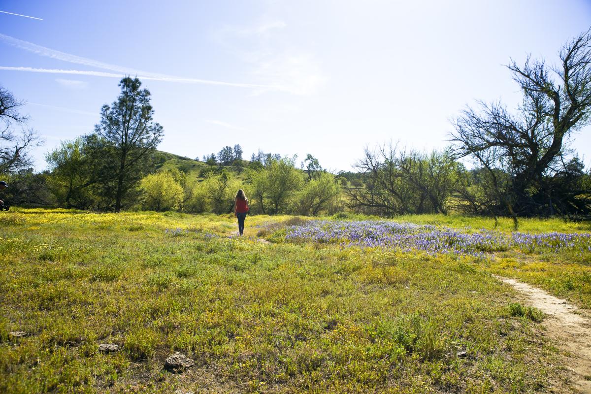
Prepare to be dazzled by one of California's premier superbloom viewing spots. In the right year, this bucket-list road trip southeast from Paso Robles to Carrizo Plain National Monument is an experience all its own, winding through wine country, past horseback-riding trails and sun-warmed ranchland, before the valley opens into an endless, multicolored carpet of blooms. Waves of yellow, purple, and pink wash across the landscape as wildflowers reach their peak, transforming the valley floor into a vast, rolling canvas of color stretching to the mountains’ edge. When the conditions come together just right, there's nothing quite like it in California.
What the Superbloom Is and When It Happens
Though never guaranteed, a spring superbloom at Carrizo Plain is one of nature's most unpredictable gifts. When significant rainfall between November and February coaxes millions of dormant seeds into blooming simultaneously across the valley floor, the result is one of the most celebrated superbloom destinations on the California Central Coast. Peak bloom typically falls between late February and mid-April, but timing shifts year to year based on rainfall, temperatures, and elevation. Checking conditions before you make the drive is an essential part of the plan.
- Peak window: late February through mid-April in strong years
- Best bloom years follow winters with above-average rainfall
- Color fades quickly once temperatures rise in late April
- Check current conditions before you go
How to Get There From Paso Robles
Head southeast out of Paso Robles and allow the scenery to steal the show. The route winds through wine country and open ranchland before the valley opens into one of the most breathtaking natural wonders in California. Plan for 60 to 90 minutes of drive time depending on how many times you pull over. Remember to fill up on gas in Paso Robles before you leave, however. Services are extremely limited once you're on the road and nonexistent inside the monument.
On the drive out:
Shell Creek Road: Your bucket-list wildflower road trip starts here, just off Highway 58 east of Santa Margarita. You’ll see plenty of pull-off points to take in this stunning springtime phenomenon along the way. Rolling roadsides burst with early-season color as you head southeast to the Carrizo Plain National Monument, with winding roads, soft green hills, and pockets of blooms, building anticipation for the spectacle that lies ahead.
- Best in strong rain years
- Narrow road with limited safe pull-offs
- Never stop on blind curves
Once you arrive:
Goodwin Education Center: Your gateway to Carrizo Plain National Monument, located along Soda Lake Road near the northern entrance. Pick up maps, get oriented, and take a moment to appreciate just how far from the everyday you've come, with wide open valley views and a sense of scale that sets the tone for everything ahead.
- Basic facilities are available nearby at the Carrizo Plain Community Center
- Hours may be limited or seasonal
- Check ahead if you're relying on it being open
7 Mile Road: Located off Soda Lake Road in the heart of Carrizo Plain, this is where the superbloom near Paso Robles comes alive. Cruise slowly, pull over as often as you like, and walk out into the color as expansive fields stretch across the valley floor, with hills rising in the distance and epic photo moments in every direction. There's nowhere else in California quite like it on a good bloom day.
- Unpaved road
- Conditions vary depending on recent weather
- Avoid driving on wet roads
- Pull off only where it is safe and legal
Caliente Mountain Ridge Trail: Accessed from Soda Lake Road, this high-clearance route climbs above the valley floor for sweeping panoramic views across the plain, where the full sweep of Carrizo unfolds below you in color and texture as far as the eye can see.
- High-clearance vehicle required
- 4WD recommended depending on conditions
What to Expect
Come prepared and soak it all in. Carrizo Plain National Monument is remote, open, and largely undeveloped, which is exactly what makes it feel so extraordinary. The valley floor stretches wide and flat, ringed by mountains, with the Temblor Range rising to the east. Roads range from paved to improved dirt to rough seasonal tracks, and cell service is limited or nonexistent across much of the area. Start at the Goodwin Education Center to get oriented, with basic facilities available nearby at the Carrizo Plains Community Center. From there, 7 Mile Road winds through the heart of bloom country. High-clearance or off-road vehicles can access the more remote Caliente Mountain Ridge Trail for elevated viewing.
Best Times of Day and Photo Tips
Get out early and make the most of the morning light. At Carrizo Plain, the low sun catches yellow and orange blooms at full saturation, the air is calm, and blooms stand tall before the afternoon wind moves in. By midday, the light flattens, and the wind picks up, so the earlier you arrive, the better the experience. Sunset can be stunning for landscape shots with the Temblor Range as a backdrop, but factor in the drive back to Paso Robles before committing to a late finish.
Suggested Full-Day Itinerary
- Early morning: Leave Paso Robles. Grab coffee and breakfast downtown before heading out.
- Morning: Stop along Shell Creek Road for early bloom views and a first taste of what's ahead.
- Mid-morning: Arrive at Carrizo Plain. Get oriented at the Goodwin Education Center.
- Late morning through midday: Cruise 7 Mile Road, pull over often, and walk out into the bloom. Stay on established paths.
- Midday: Picnic lunch. Bring everything you need. There's nothing to buy inside the monument.
- Early afternoon: Continue exploring or venture toward Caliente Mountain Ridge if you have the right vehicle.
- Late afternoon: Begin the drive back toward Paso Robles.
- Evening: Roll back into Paso Robles in time for a tasting on the Wine Trails or dinner downtown.
Safety
Know before you go. Dirt shoulders across the valley floor can look firm yet give way fast, especially after recent rain, and getting a standard vehicle stuck out here is easier than it sounds. Tow services are few and far between. Bring significantly more water than you think you need, as the plain is exposed and temperatures climb quickly once the morning cool burns off. Roads marked closed are closed for a reason, and the remoteness that makes Carrizo Plain so spectacular also means there's no safety net if something goes wrong. Leave yourself enough time to be back on pavement well before dark.
Leave No Trace in Wildflower Season
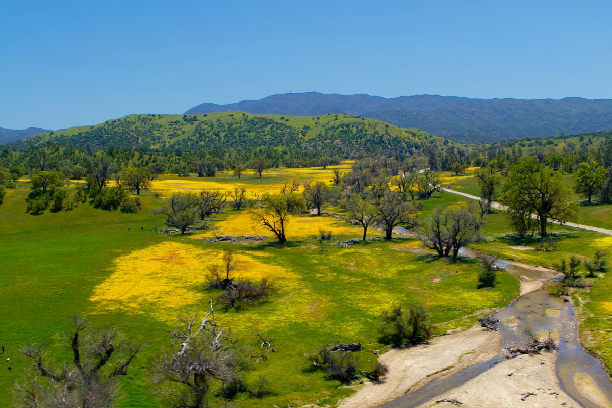
The blooms that make Carrizo Plain and the Paso Robles hills so extraordinary are also remarkably fragile. Traveling thoughtfully here isn't just good etiquette. It's what keeps these landscapes worth visiting season after season. A few simple ground rules go a long way.
- Stay on established trails and designated pull-offs. Stepping into a bloom field for a closer photo causes more damage than it looks like from the outside.
- Leave every bloom where you find it. Picking wildflowers is illegal on state, national, and BLM land and shortens the season for everyone who comes after you.
- Give wildlife plenty of space. Spring is active nesting season for ground-dwelling birds and small mammals. If an animal changes its behavior because of your presence, you're too close.
- Keep dogs leashed at all times where permitted and check dog policies before arriving. Some preserves and monument areas restrict dogs entirely during nesting season.
- Pack everything out. There are no trash facilities within Carrizo Plain National Monument, and limited options along rural Paso Robles back roads. Leave every stop exactly as you found it.
- Respect private property. Much of the land along scenic back roads is privately owned ranchland. Admire it from the road and move on.
Wildflower & Superbloom FAQ
When is wildflower season in Paso Robles? Wildflower season typically runs from late February through early May, with peak bloom falling in March and April in most years. Timing shifts depending on winter rainfall and spring temperatures.
What's the best month to visit for wildflowers? March is the most reliable month for peak color in and around Paso Robles. April is worth considering if you prefer a quieter visit or want to catch later bloomers in shaded canyons and higher elevations.
What types of wildflowers are found and seen in Paso Robles? The region is known for California poppies, lupine, owl's clover, goldfields, phacelia, and tidy tips, though exactly what's blooming in any given spring depends on winter rainfall, temperatures, and where you explore.
Where are the easiest spots to see wildflowers without hiking? The Adelaida Road corridor, Vineyard Drive, and Highway 46 West all offer excellent bloom viewing from the car or with minimal walking. All three scenic drives outlined above are designed for road trippers who want the scenery without a trail map.
Are dogs allowed on wildflower trails? Dogs are welcome on leash at several Paso Robles area parks and trails, including Santa Margarita Lake Regional Park. Policies vary by location, so check before you go. Dogs are restricted in parts of Carrizo Plain National Monument during nesting season.
What should I bring for a wildflower day? Water, snacks, sun protection, and layers for the morning chill. If you're heading to Carrizo Plain, pack a full lunch — there are no food services inside the monument. Download offline maps before you leave, as cell service is limited on remote routes.
Is the Carrizo Plain superbloom guaranteed every year? No. The superbloom depends on above-average winter rainfall and favorable spring conditions. Some years produce spectacular color, others produce very little. Always check current bloom conditions before making the drive.
How far is Carrizo Plain from Paso Robles? Carrizo Plain National Monument is roughly 60 to 90 minutes southeast of Paso Robles depending on your route and how many times you stop along the way.
Do I need AWD or a truck to visit Carrizo Plain? Not necessarily. The main routes through the monument, including 7 Mile Road, are often passable in a standard vehicle in dry, well-maintained conditions, though conditions can change quickly. After rain, dirt roads and shoulders soften quickly. High-clearance or off-road vehicles open up additional routes, such as the Caliente Mountain Ridge Trail.
Are there restrooms or food near Carrizo Plain? Restroom facilities are limited to a port-a-potty near the Carrizo Plains Community Center. There are no food services inside the monument. Bring everything you need from Paso Robles before you head out.
What time of day is best for wildflower photos? Early morning is ideal. The light is warm, the air is calm, and blooms stand tall before the afternoon wind moves in. Golden hour at sunset works well for landscape shots with the Temblor Range as a backdrop.
Can I pick wildflowers at Carrizo Plain or on Paso Robles trails? No. Picking wildflowers is illegal on state, national, and BLM land. Leave every bloom exactly where you found it.
How do I check current bloom conditions before I go? The Theodore Payne Foundation Wildflower Hotline is the go-to source for weekly bloom updates from March through May. Visit the Wildflower Hotline.
Spring is calling. Let's go to Paso.
Cowboys and innovators, winemakers and wildflower chasers: Paso Robles has always drawn the kind of people who know a good thing when they find it. Find your good thing this spring. Pair a morning in the wildflowers with an afternoon on the Wine Trails, a farm-to-table dinner downtown, or a night at one of the region's friendly wine country lodging options.
Check the Paso Robles Events calendar today and start planning your visit.